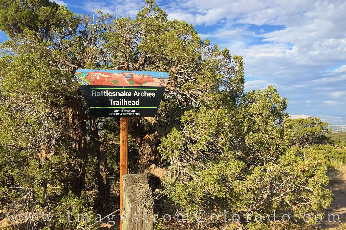
The Beauty of Rattlesnake Canyon and Rattlesnake Arches
It started several months ago when I was researching “off the grid” places to shoot. Colorado National Monument had been one of my favorite locations as I love the canyons and red rock. But just to the west of CNM, a dirt road connected a huge plot of land called McInnis Canyon National Conservation Area, and one area within its boundaries that piqued my interest – Rattlesnake Canyon and Arches. I studied the map for a while, looked online at various images, and tried to figure out how to access this location. The four-wheel drive road was known for being a monster. And while I have a 4WD 4Runner, I didn’t want to put my car through such distress. The other option was a 15-mile round-trip hike, but this was probably not doable as I’d have to lug a lot of camera equipment as well as camping gear. I don’t travel that light when shooting. And shooting at sunrise and sunset was imperative, as I’d not seen any good images from this location shot at the golden hour.
So enter a friend of mine, Dale. Dale was raised in the Grand Junction area, as were his parents and grandparents. He knows the area and has friends in high and low places, geographically speaking. When I was out in Grand Junction at CNM shooting about a month ago and mentioned my interest in the Rattlesnake Arches, he said to come back anytime and he’d show me around. Not to pass up an opportunity such as this, I accepted and made the return trip from Winter Park to the western slopes for an overnighter into this remote area.
The drive to Dale’s house took just under 4 hours with me arriving around 4pm. After short pleasantries with his family, we headed out for the two-hour drive that took us into the McInnis Canyon NCA. Dale’s 15 year-old son joined us, as well. I won’t use his name here since he is a minor. I’ll just refer to him as Dale’s son from here on out.
We entered Colorado National Monument, and after several miles of nice paved road, we turned right on Black Ridge Road. After that, I do not know the twists and turns we took. I know it was another hour or so on what started out as smooth red dirt roads, but soon path soon changed into crater-filled, hold-onto-anything-you-can 4WD roads that left my neck and back wondering what was going on. The last portion of the road, maybe a mile, proved especially rough, and I was thankful for Dale’s expertise and his ultra-rugged truck that handled these boulders and landed us at the trailhead.
I wasn’t sure which lenses to bring, so I had packed three, covering the ranges from 11mm-200mm. Along with a tripod and a lot of water and Gatorade, my backpack was fairly heavy. By 6:30pm, we were off on the trail to scout and shoot at sunset. The trail leading to the first arch winds and curves about 1.5 miles slight downhill on a fairly easy path. We arrived on the canyon rim, scaled down some stable rocks, and soon were standing near the top of the first arch, known as Cedar Arch.
* From here, a trail runs west along a ridge. Several arches are visible as you traverse a rocky but relatively easy and stable path for a mile or so of the trail. The arches will be slightly below you – and at one point I inadvertently walked out onto an arch (not realizing it was an arch).*
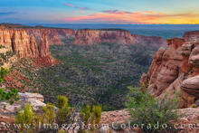
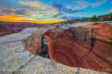
Back to the story – standing just above Cedar Arch facing southeast… I distinctly remember thinking “that’s a long way down.” With storm clouds in the distance, I wanted to get a photograph of the arch with the clouds in the distance (I’ve learned not to pass up a shot, thinking I would return to get it later – that rarely works out).

Dale took a few photographs while Dale’s son took in the view. After a few minutes, I asked what’s next. Dale said we could either take a shortcut to the lower portion of the Arches Loop – downclimbing the sandstone beneath Cedar Arch – probably 100 feet or so of a Class 3/4 scramble - or stay up top. From where I was standing, I couldn’t even see the bottom where we’d end up. Dale asked his son to check out the route down. His son disappeared for a few minutes, then returned saying it was fine with good footing and handholds. After some discussion, and with the light fading and the potential for a good sunset, we decided to downclimb this area the next morning, but for this evening we’d stay up top.
From here, we explored along the canyon wall. We found several of the arches. I should note here that in researching these arches, each arch seems to have several unofficial names. My two favorites for photography were the iconic Rattlesnake Arch (also called Rainbow Arch, Centennial or Akiti Arch), and one who’s name I’ve only heard of as “the Furnace.” This name is derived from the way the late sun in summer illuminates the inside of the arch.

Dale, his son, and I spread out along the ridge, each doing our own thing. Dale walked on to reach “Crocodile Point” which overlooks the distant Colorado River while I stayed to shoot Rattlesnake Arch and the Furnace at sunset. The last light and colors of the evening were simply amazing.

After this, we met up again near Rattlesnake Arch, talked for a few moments, then made the hike out to Dale’s truck. We drove about 15 minutes over dark, bumpy roads and set up camp for the night. While I was actually comfortable on my pad in my tent, it was not a good night sleep. After sweating profusely during the evening hike and with temperatures still pretty warm, it was a humid, sticky night. While sleep was lacking, the wake-up time of 4:15am was quick to arrive, and soon we were eating a quick snack, then packing up and driving back to the trailhead.
Dale and I made the hike back to Cedar Arch in the dark. Dale’s son stayed behind to finish eating, but soon came jogging down the trail. We stood above Cedar Arch in the soft glow of early morning light. As I peered down, I couldn’t see the bottom, and that made me nervous. Dale’s son scrambled down a little ways ahead of us, then we used ropes to lower the camera gear down to him, repeating this process several times as we butt-scooted and inched ourselves down. Eventually, and to my relief, we reached the bottom. I was a little surprised when Dale said “that was easier than I thought.” I commented that I thought he’d done that scramble many times. He just smiled and said “nope.” What had I gotten myself into?
We spent the next hour exploring a trail beneath the arches, shooting occasionally and enjoying the unique terrain. While sunrise wasn’t as brilliant as sunset the previous night, the soft blues and pinks of morning were still quite pleasing, adding color and contrast to the red rocks below.

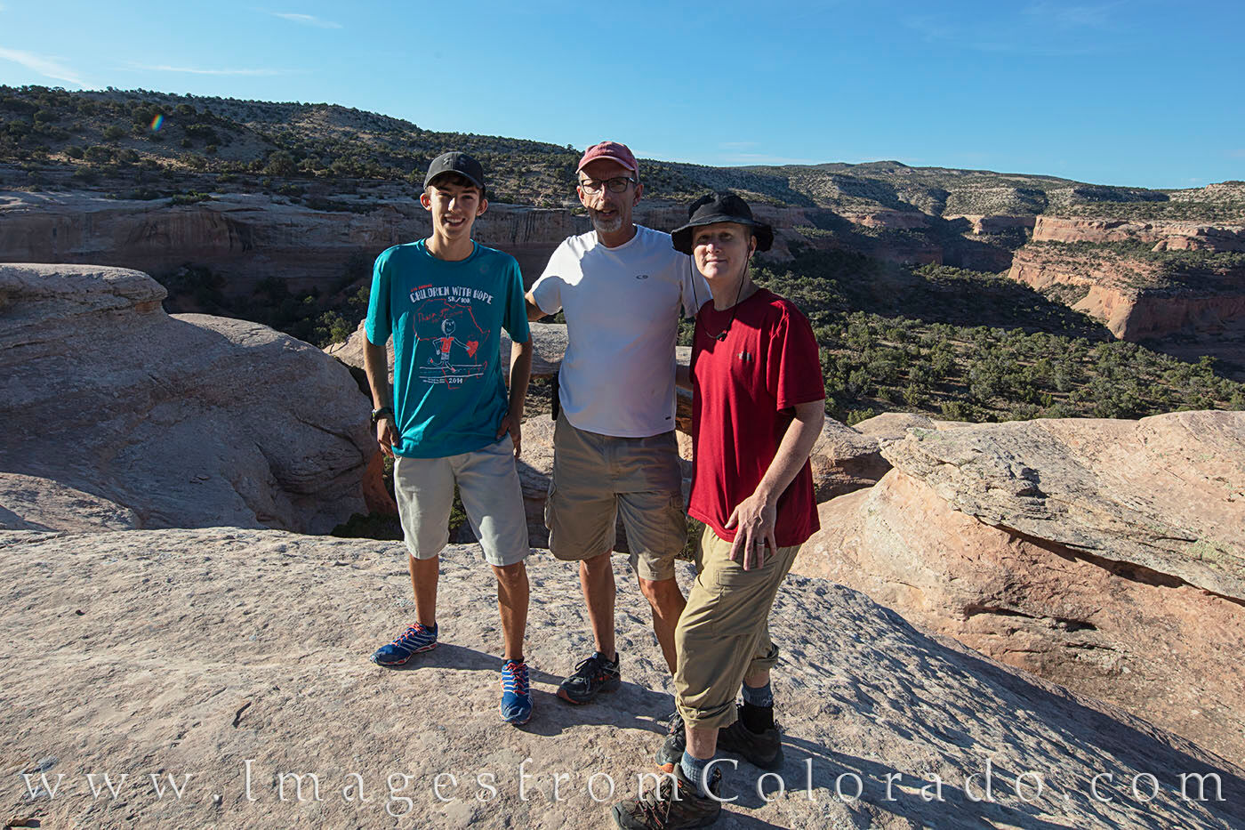
With the sun rising and heating the canyon quickly, we made our way back to Cedar Arch for one final ascent up the steep sandstone. While Dale’s son scaled it with ease, even carrying the camera equipment and another backpack, I was a little slower going. Ah, to be young again. From the top of the arch, one final sunburst was captured, along with a group shot.

After that, we made the trek back to the truck, then the long slow grind out of the McInnis Canyon NCA, back into Colorado National Monument, then back to Dale’s house in Grand Junction.
After some goodbyes and future plans, I made my way back to Winter Park, but not before enduring the cluster that is currently I-70 East. What should have been a 3:45 drive stretched out to over 5 hours because of road construction.
Still, CDoT couldn’t dampen my enthusiasm for the past few days, and I am already looking forward to returning again for some more exploring in this amazing area.
Until then, thanks to my friends for their hospitality, patience, and willingness to share a place that holds a special place in their hearts. I don’t take that lightly.
Until then, I wish everyone safe travels!
~ Rob
All images are copyrighted by © Rob Greebon Photography No files or written content found within this site may be used or reproduced in any form without the expressed consent of Rob Greebon.
If you have any questions about these photographs from Rattlesnake Canyon and Arches, please do not hesitate to contact me.